Comparing predicted data vs. measured data is a fundamental process in weather forecast model development and optimization.
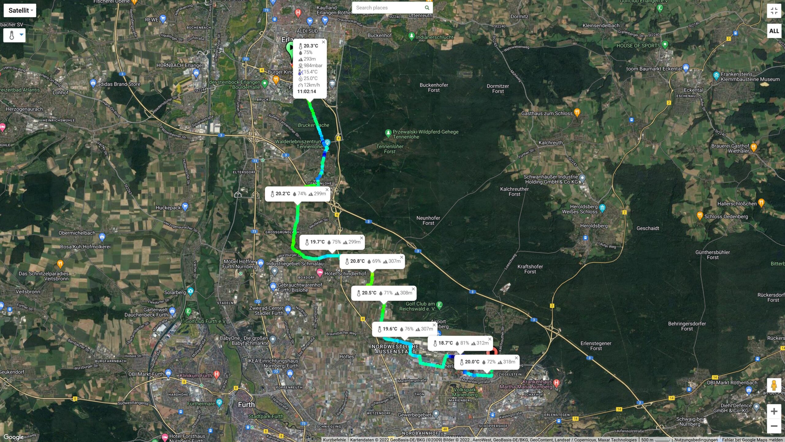
Unlike the static observations performed with fixed weather stations (which suffers from spatial under sampling), with MeteoTracker it is possible to scale the model output verification (and data assimilation) down to meters-level resolution, as shown in the image below, which illustrates an interesting comparative analysis made by Kofelheini – Erlanger Wettergucke in the Nürnberg area (Germany).
The predicted values are from Meteologix, the actual data are collected by MeteoTracker.
The parameters considered were temperature and humidity (thanks to the new multi-parameters map, all the parameters measured or calculated by MeteoTracker can be displayed on the map -> app.meteotracker.com).
https://twitter.com/Kofelheini/status/1533827680168292357


The massive data collection enabled by the on-the-move measurements paradigm (vehicles as travelling weather stations) allows the deployment of AI and Big Data tools in the development of hyper-local weather models, which are of increasing importance in many contexts, for example in urban areas, where the climate change is exacerbating the urban heat island effect and, thus, the heat waves impact.

MeteoTracker is the first mobile weather observations network, include so far more than 800 units with more than 19milion weather points collected.
The mobile weather station comes in 2 different versions:
✔the smartphone version, where the smartphone works as a geo-tagger, gateway to the internet and user interface for data visualization and analysis (Android and iOS mobile App);
✔the standalone version, where geo-tagging and connectivity is performed by a cellular/GNSS module for a complete automation of data collection.
0 Comments